
HN's go-to recommendation for colormap and color-perception questions; commenters call it funny, brief, clear and a favorite talk.
Topics › AI, Machine Learning & Data
The best data visualization & information design videos, according to Hacker News
53 videos about data visualization & information design that Hacker News commenters keep pointing each other to, ranked by how many separate months they were recommended. Part of AI, Machine Learning & Data.

HN commenters send it as a short antidote to cynicism, showing long-term global progress and the shrinking gap between rich and poor countries.

HN repeatedly recommends it to counter overpopulation alarm with data on falling birth rates.

HN commenters drop it whenever wealth inequality comes up, as a quick visual of the gap between perceived and actual distribution.

HN recommends it for mind-blowing visuals that make cell biology tangible.

HN commenters recommend it as a quick visualization of the scale of global poverty versus immigration capacity, though it is advocacy with a specific viewpoint.

Recommended as evidence that the world is improving despite negative news, and for how people misjudge global trends.

HN invokes it as the classic evidence that the world has improved and that people misjudge it, and as an example of great data presentation.

Regarded as one of the coolest talks ever, with a futuristic binary visualization demo that has inspired later tools.

HN pointed to it during 2020 as a digestible, well-made illustration of epidemic dynamics and interventions.

Shared as a go-to humbling look at cosmic scale, noted for its chilling audio and visuals pairing.

HN commenters cite it in voting-reform threads as a visual argument that cardinal systems (STAR, approval) beat plurality and ranked-choice voting.

HN points to it in population, climate, and birth-rate threads as a clear, light-hearted overview of the demographic transition.

Recommended whenever population growth comes up, as a data-driven correction to common assumptions.

Shared as a beautiful example of lattice-based harmony visualization.

Offered as an approachable, data-driven rebuttal to Malthusian overpopulation fears.

Cited as the classic data-driven argument that the first-world versus third-world split is outdated and the world is improving.

A classic that HN points to for seeing how sorting algorithms behave, valued for how satisfying it is to watch and hear.

HN treats it as one of the canonical Bret Victor talks, cited whenever discussion turns to better tools and interfaces for thinking.

HN commenters say it permanently changed how they think about inspecting binary data, and point to it as the origin of visual binary analysis tools.

Counted among Bret Victor's best talks and recommended to anyone exploring direct-manipulation tools.

HN people share it as an eye-opening, moving visualization of the scale of the universe.
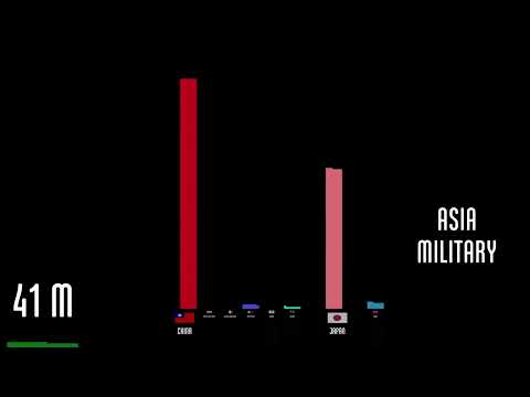
HN cites it for a sense of the scale of WWII casualties by country and the long decline in violence.

HN people point to it for intuition about why some games are hard to navigate and for its Rush Hour and graph visualizations.

HN links it in any thread on map projections and the Mercator distortion of country sizes, often calling it a favorite scene.

Recommended in threads on German rail as the data-backed explanation of how reported punctuality understates real delays.

Recommended as an incisive look at the real potential and common misuse of data sonification, often brought up in threads on space sonifications.

HN points to it as a data-driven, worldview-changing explanation of why global population will level off.

Recommended as a way to grasp the scale of the universe and what the Hubble deep field image means.

It is the go-to link in any HN thread on map projections, usually posted as the obligatory West Wing reference.

Used as a striking visualization of the sheer scale and rhythm of nuclear testing, and as a model for conveying scale with a counter.

HN commenters cite it as a clear, numbers-based rent-vs-buy comparison when housing-as-investment debates come up.

HN links it in data-visualization threads as an entertaining case against violin plots.

People link it as the quick answer to how Google builds 3D maps, and as evidence that planes are still used to capture the imagery.

HN recommends it as an insightful, perspective-giving look at how people live across income levels, useful as a counter to pessimism.

Cited as a data-backed counter to doom and pessimism about the state of the world.

HN commenters link it as the full record of r/place whenever the experiment, or collaborative canvases in general, comes up.

HN commenters use it as a vivid illustration of how CO2 is distributed and how vegetation absorbs it seasonally.

HN points to it as an intuitive way to see what hidden layers of a convnet learn, and as a reference for hierarchical feature learning.

HN people point to it as the canonical explanation from the method's author whenever t-SNE comes up.

Cited as a cool, concrete visualization of Wi-Fi interference patterns.

HN points to it as the detailed explanation of why hexagons suit map grids, in threads about H3.

Shared as the best visceral demonstration of solar system scale.

Shared as the canonical example of visualizing a real project's version control history with Gource.

HN uses it as a quick visual reference for how asteroid detection capability grew and how discovery patterns are biased by survey geometry.

Referenced when discussing how much time household technology saved families and how heavy housework used to be.

HN links it as a reference for the history and distribution of nuclear tests, and occasionally as an example of audio data presentation.

Cited as a data source for historical language popularity, though not as a recommendation.

HN users link it whenever a thread needs a quick illustration of how much European borders have shifted and how much conflict there was.

Linked in threads on the Tube map and transit map design history.

Used as a reference timeline in arguments over whether information was suppressed, with commenters noting a possible pro-China bias.

HN uses it to illustrate orbital debris evolution and how altitude determines how fast debris decays.
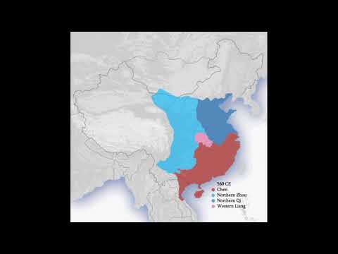
Cited in passing to show how China's borders have expanded and contracted over history.
Which of these have you already seen?
Connect YouTube and HackerTube AI hides what you've watched and ranks the rest for you.